Airstrip Info
| Frequency | 122.90 |
|---|---|
| Elevation | 3879 ft |
| Lat/Long |
37.8948, -110.3778 37° 53.688' , -110° 22.668' |
| Runway 10/28 |
2200 ft
x 30 ft
Paved Rwy 10 Uphill 1.8% |
| Ownership | NPS NRA |
Weather
See more at the National Weather Center
Information updated March 15, 2023 @ 6:46pm
Description: Hite is heavily used during the spring, summer, and fall months by air tour operators. Prior Permission Required.
Runway: 2200 ft long x 30 ft wide paved runway.
Approach Considerations: Land east, takeoff west.
Amenities: Picnic table and covered pavilion at the east end.
Windsock: Yes
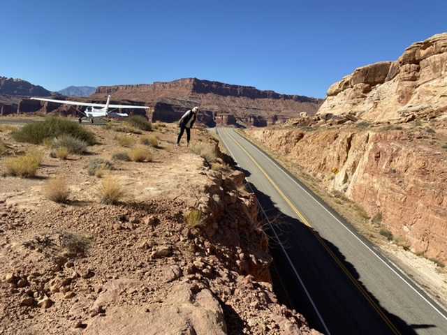
There is a shade shelter and picnic table at the Hite airstrip. Beautiful overlook of the confluence of the Dirty Devil River and Colorado River, which marks the upper end of Lake Powell. The Hite Crossing Bridge over the Colorado River is adjacent.
https://en.m.wikipedia.org/wiki/Hite_Crossing_Bridge
It is not a good place to camp, as the airstrip is adjacent to the highway. No water or services.
We haven't written a history for this airstrip yet. If you would like to provide us with some information about this strip, please contact us today!